
The Rice Lake Early to Middle Archaic: Evidence of Bifurcate and Stanly/Neville Projectile Point Horizons in the Rice Lake/Trent River Wetlands of South-Central Ontario by L. Jackson and F.J. Krist (2019) (APA Occasional Papers No.3) **.pdf by email**
Description
Full-colour .pdf file will be sent by email.
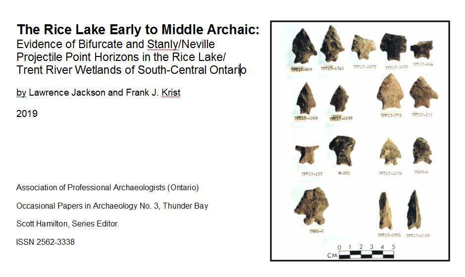
This paper proposes that the Rice Lake region of south-central Ontario had substantial Early to Middle Archaic occupations (circa 8,900-7,500 RCYBP) based upon evidence from comprehensive regional surveys conducted in the 1980s, and largely unpublished site excavation data from the 1970s. These occupations were contemporaneous with gradual Holocene flooding of the Rice Lake basin due to isostatic rebound. Two projectile point “horizons” are documented: 1) a late Early Archaic bifurcate base horizon, (typically on small triangular bladed, eared corner-notched points with deep basal concavity); and 2) an early Middle Archaic corner-notched/stemmed horizon (with small, triangular bladed points varying from corner-notched to straight stemmed and eared, but lacking base bifurcation).
Projectile point data is presented from 14 sites on or near Rice Lake and the Trent River. These sites suggest that widely distributed late Early Archaic bifurcate and early Middle Archaic stemmed point horizons existed during a lengthy period of cool and wet climate that ended with hypsithermal warming. This warm and dry interval began about 6,560 RCYBP after the early Middle Archaic (Yu and McAndrews 1994). Detailed water level mapping in relation to Early to Middle Archaic site locations indicates a significant focus on wetlands which were being constantly created by incremental flooding of the Rice Lake basin, and also much wetter than modern interior valley environments near streams, headwaters, and artesian springs. The juxtaposition of riverine, estuarine, lacustrine and marshland environments on island and palaeo-shoreline Rice Lake sites would have presented considerable ecodiversity and resource exploitation opportunities to Archaic populations.
