

UAV (drone) aerial photography and photogrammetry and its utility for archaeological site documentation by Scott Hamilton and Jason Stephenson (2017) (APA Occasional Papers Series No. 2) **.pdf version -- the file will be emailed to you**
Description
Full-colour .pdf file will be sent by email.
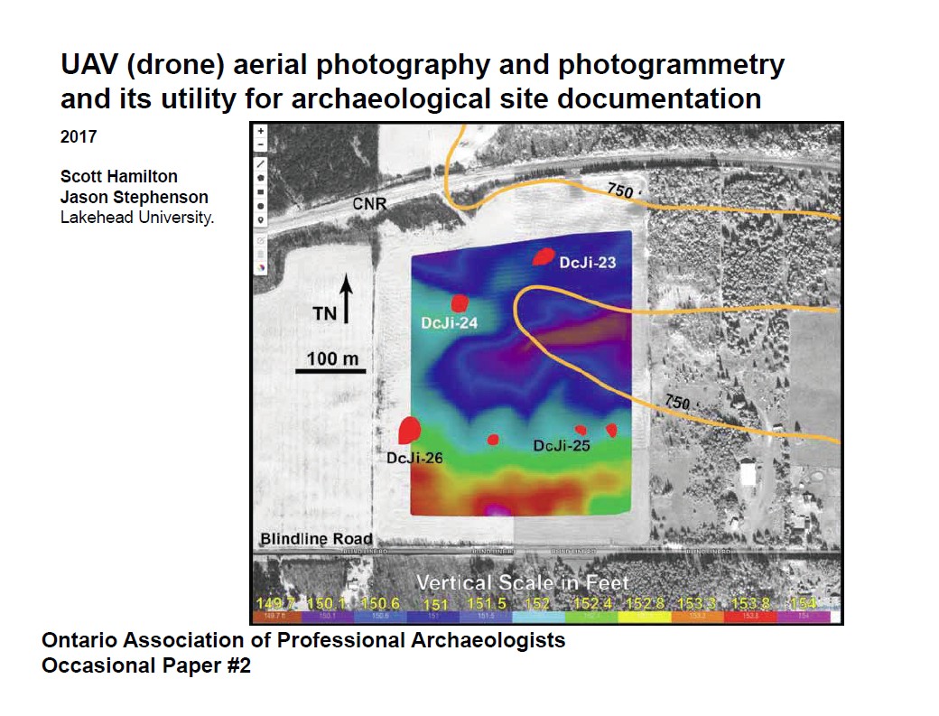
The technological development of Unmanned Aerial Vehicles (UAVs or drones) and their marketing as recreational devices offers considerable potential for field documentation and research in a number of disciplines, including archaeology. Early experimentation with UAVs is reviewed, outlining strengths and limitations of the technology using several case studies. This includes evaluation of data resolution and precision under different conditions compared to conventional maps and satellite imagery, and also consideration of equipment purchase and operational costs relative to cost-effectiveness of drone-assisted site mapping. The utility of UAVs for archaeological mapping is considerably enhanced when used with semi-autonomous flight planning software, photogrammetric data processing, and refinement and analysis of output within Geographic Information Systems. One important constraint upon widespread use of UAV-assisted air photography as an archaeological research tool is the increasingly complex regulatory environment, coupled with the requirement for insurance coverage.